The data goldsmith
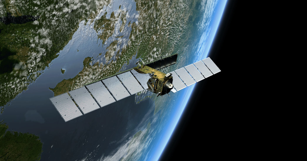
Every day, more than 21 terabytes of data from Earth observation satellites flow into DLR's Earth Observation Center (EOC). Today, the vast amounts of data are processed into image and information products with the help of AI and used in research.
At that time, DLR was still called DFVLR: Deutsche Forschungs- und Versuchsanstalt für Luft- und Raumfahrt. Films were shown on one of the public programs or on screen in the cinema, "Was bin ich? - Heiteres Beruferaten" with Robert Lembke was on TV, Helmut Schmidt was Chancellor of Germany and the push-button telephone had just been introduced. At this time, in 1980, a new scientific and technical operating facility was established in Oberpfaffenhofen: the Applied Data Technology Department - a forerunner of today's German Remote Sensing Data Center, DFD, which together with the DLR Remote Sensing Technology Institute forms the EOC.
The beginnings: data on magnetic tapes
One of the first tasks of the new company was to receive and process data from the TIROS satellites, the first satellites for weather determination and forecasting. In the early days, the only electrical device in the office was a telephone - still with a dial. Drafts, documentation and calculations were done by hand. The departmental computer was shared. It was operated via an alphanumeric terminal, to which a type wheel printer was connected. Technology such as "frame synchronizers" and "communication elements", which were to receive data streams from space, had to be developed and built for the most part by the company itself. They were needed as an interface to the computers, which were not very powerful at the time.
A highlight in 1985 was the German Spacelab mission (D1). For the laboratory on board the space shuttle "Challenger", the scientists of the then still young institution built a so-called Data Selection Unit (DSU). This unit was used to select data from the space lab for transmission to Germany. Transmission via satellite was still far too expensive for the entire data stream. On the other side of the divided Germany, in Neustrelitz, the Institute for Cosmos Research of the Academy of Sciences of the GDR was listening into space, receiving data from the Soviet INTERKOSMOS satellites, the first European Meteosat and the American NOAA satellites. Receiving antennas had been operated here since 1969. After the fall of the Berlin Wall, the German-German capabilities were finally united and Neustrelitz became the site of DFD. The 1990s were a time of rapid technological development: the second German Spacelab was launched with the "Columbia" space shuttle, Europe put its first satellites into space, and the U.S. expanded its Landsat satellite fleet. DFD was contracted by the European Space Agency (ESA) as a data center to distribute Landsat data to users. This meant sending the data on magnetic tapes to the few users in Germany who could already handle this new data technology. Or creating a photographic image print of the satellite scenes. For this purpose, DFD operated its own geoscientific photo laboratory, one of the most modern of its time.
Strategically located ground stations - worldwide
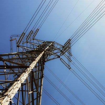
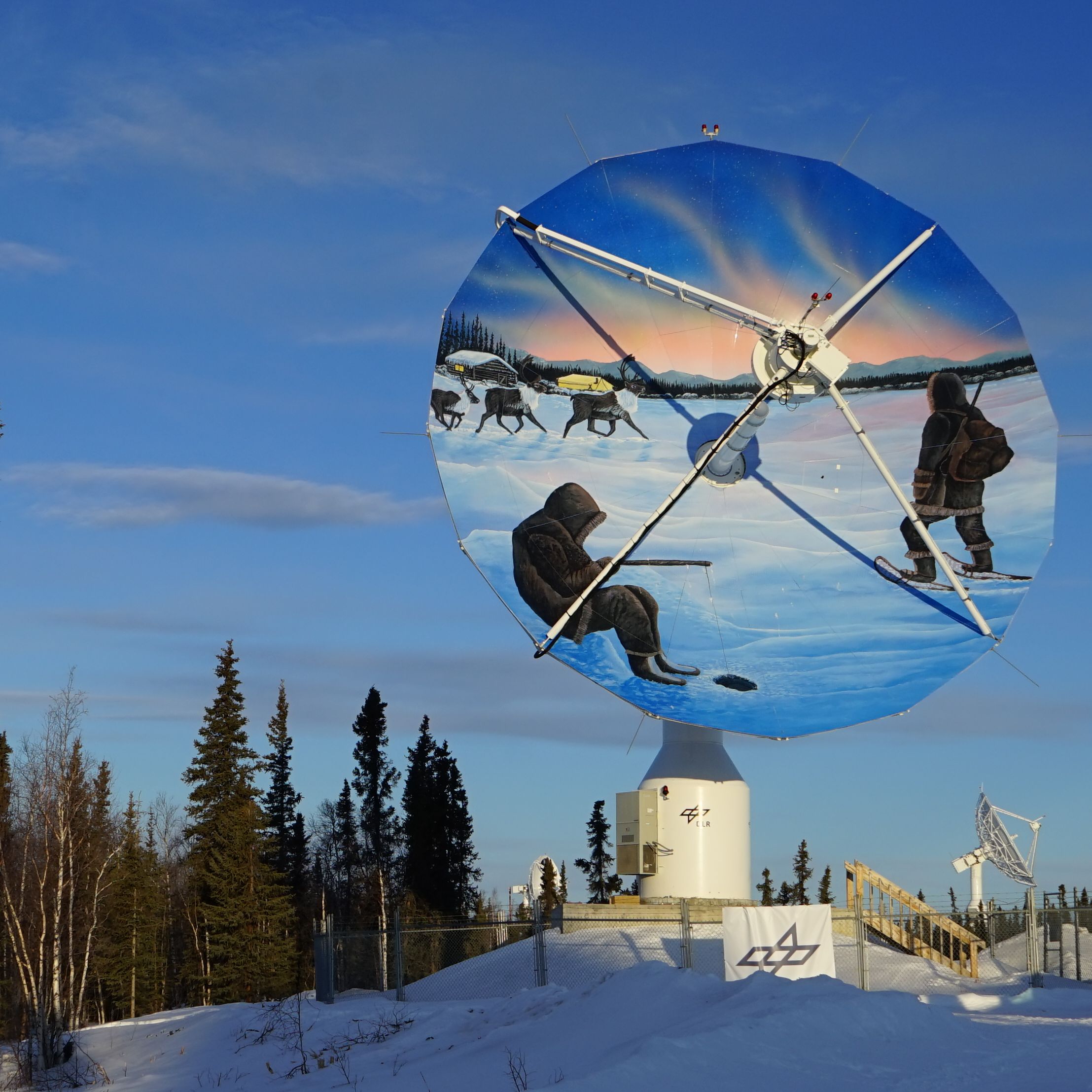
With the first European Earth observation satellites, ERS-1 (1991) and ERS-2 (1995), a new era began not only for Europe but also for the precursor of the EOC. The data from the sensors at that time could not be stored on board the satellites. Thus, in order to be able to map rainforests, deserts, and ice masses, data reception was dependent on strategically located ground stations that were close to the observation areas. With national funding, the first satellite receiving station on the Antarctic continent, the "German Antarctic Receiving Station (GARS)", was put into operation in 1991 near the Chilean station Bernardo O'Higgins. It received data from the ERS satellites over Antarctica. Following this logistical and technical masterpiece, further temporary receiving stations were set up by DFD: for example in Gabon in West Africa, in Kyrgyzstan, in Mongolia or in Mexico. Today, in addition to the antennas in Oberpfaffenhofen and Neustrelitz, the receiving network includes the GARS O'Higgins stations and another near-polar station in Inuvik in the Canadian Arctic. Such polar locations have now proven their worth for maximum data yield due to their more frequent contact times with the satellites.
The Age of Big Data
Much has changed since the launch of the first European satellites. Today, Europe has its own large fleet of Earth observation satellites. The "Sentinels" of the Copernicus program provide data for everyone - free of charge on the Internet. It is just twelve years since the USA first initiated the "free & open" development and declared recordings from the Landsat satellites to be public domain. Image scenes that previously cost hundreds of dollars were suddenly freely available. The EU picked up on this idea. Today, most satellite data is freely available. Only the highest spatial resolution data in the meter and sub-meter range is marketed commercially. But even this market is changing since start-ups discovered Earth observation for themselves. Small and micro satellites down to shoebox size based on conventional components are now being launched into orbit by the hundreds, delivering high-resolution images of the entire Earth every day. Potential failures are part of the concept. And image quality and geometric accuracy are only optimized on the software side after data reception in large data centers
From space to the cloud
Today, such data centers allow small research groups and even individuals to create global Earth observation products. Whereas until a few years ago users had to download their data to their own PCs and process it there, today the raw data often remains in the data centers, so that only the algorithms are uploaded to the data. Companies like Google and Amazon have discovered this field for themselves. They offer access to the European Copernicus data and the necessary computing power from a single source - in some cases free of charge for researchers, at least as long as they expect to benefit from it. Today's EOC operates in the middle of this extremely dynamic environment. For more than 40 years, the facility and its predecessors have helped shape Earth observation. For example, parts of ESA's ground segment were designed by its teams. The EOC is still responsible for the reception, processing and management of satellite data on behalf of ESA and has been able to hold its own in what has become a commercialized market. It is also currently developing a promising alternative to the large commercial providers for processing data in the cloud, in collaboration with the Leibniz Computing Center of the Bavarian Academy of Sciences and Humanities. This application is intended to preserve sovereignty in accessing and processing satellite data.
At the forefront of radar remote sensing
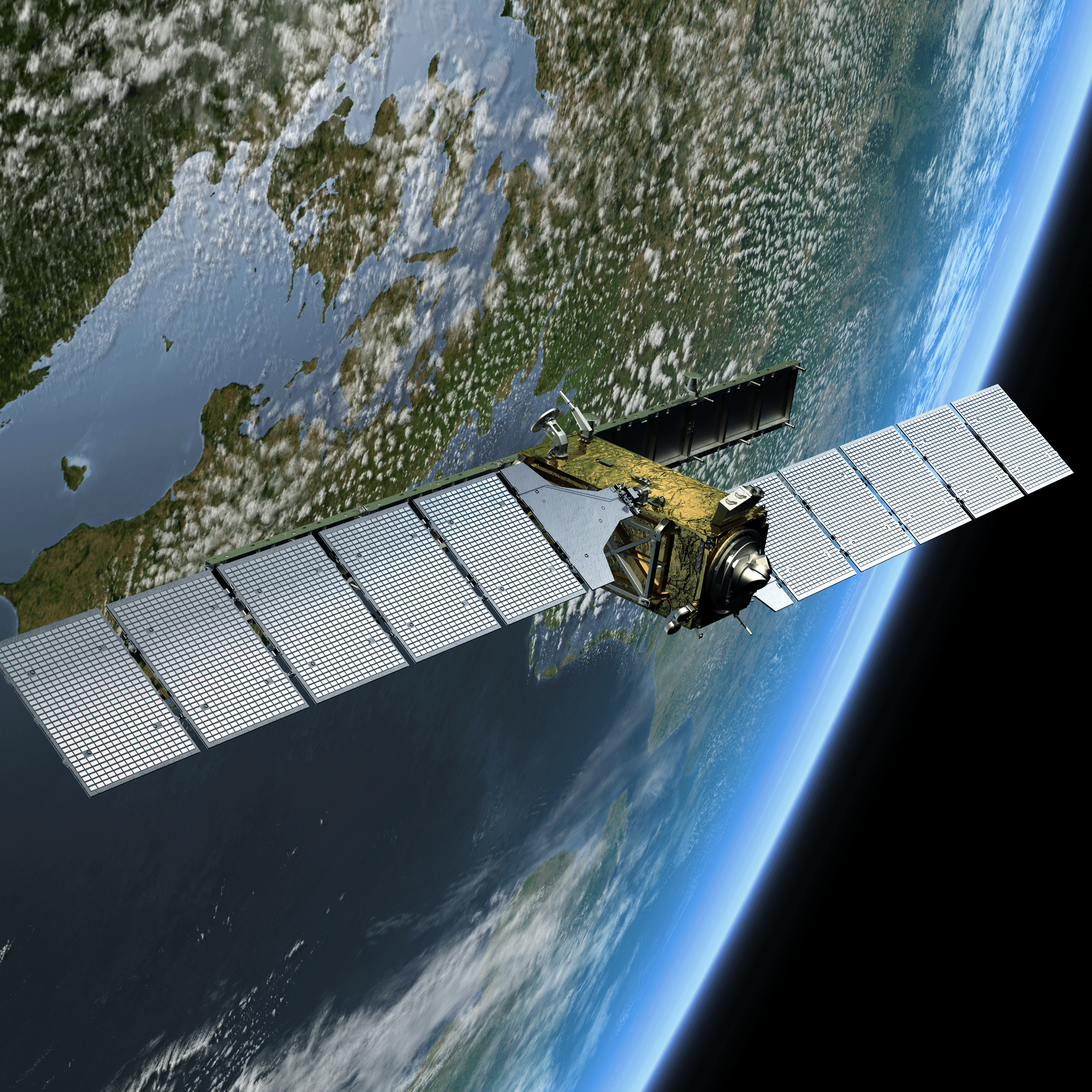
The EOC and its predecessor facilities have grown up together with ESA and its space program. However, the EOC has also drawn particular strength from national radar missions and programs: in 1994, SIR C/X-SAR, the world's first radar system operating in the X-band frequency range, was launched; in 2000, the first SAR (Synthetic Aperture Radar) interferometer premiered on the SRTM remote sensing mission. This sensor made it possible to create terrain models of the Earth for the first time. In 2007, the TerraSAR-X satellite was launched. It carries a radar sensor that can be operated in different modes. Three years later, its twin satellite TanDEM-X followed. The two fly in close formation, enabling simultaneous images of the Earth's surface (known as a bistatic interferometer). No other space nation had previously had two satellites orbiting each other in a helix just a few hundred meters apart to produce a high-resolution, uniform global terrain model for the first time. Like no other project before it, the TanDEM-X mission revealed DLR's unique selling point, its system capability: satellite control, instrument development, data processing and evaluation from a single source. For all these national missions, but also for all ESA atmospheric missions, the EOC was able to develop the processing algorithms from the first sensor to the user product and to significantly exceed the set targets. Germany thus became the world leader in radar remote sensing. The data volumes of these missions also eclipsed anything that had gone before. Thanks to this "training," the EOC can now also process the much more massive data masses of the European Copernicus program.
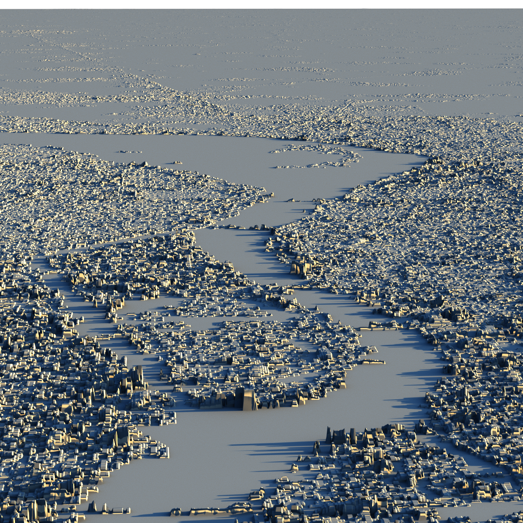
Artificial intelligence and social media for Earth observation
To analyze this "Big Data" treasure trove, the EOC established the research area "Artificial Intelligence for Earth Observation." The EOC's Earth science research has also been spurred by the wealth of data. For example, as a byproduct of the TanDEM-X mission, the world's most accurate settlement map of the Earth was created. Today, it continues with Sentinel data and is supplemented with elevation information from the TanDEM-X data. With the help of Big Data, artificial intelligence and social media data, the EOC scientists are even recording the type of buildings in the settlements. This makes it possible to determine the distribution of the population much more precisely. This information is important for mapping risk areas, such as those produced by the EOC's Center for Satellite-Based Crisis Information (ZKI). Atmospheric research also benefits, as it can not only determine the exposure of people, but also estimate the number of people affected, taking into account the health risk indices. This involves the use of an information system that evaluates which health risks are caused by various environmental influences. These environmental influences include air pollutants and meteorological influences such as air temperature, radiation temperature, wind and humidity.
Earth observation has now become part of people's everyday lives. The amount and variety of data, processing capacities and algorithms accessible today could not even be dreamed of 40 years ago. Today's possibilities of the Internet, the extensive satellite fleets and mobile applications in everyday life were simply unimaginable.
Authors: Prof. Dr. Stefan Dech, Director of DLR's German Remote Sensing Data Center, and Prof. Dr. Richard Bamler,Director of DLR's Remote Sensing Technology Institute. Both are heads of DLR's Earth Observation Center.
This article first appeared in DLRmagazin 166 of the German Aerospace Center (DLR).